Tag Archive | Portland

Man O’War Cove and Durdle Door, Dorset

Last Saturday (30 June) we rather rashly decided to visit the Dorset coast – along with most of the rest of the UK, it seemed. The weather has been scorching and so we decided we wanted to see Man O’War Cove and Durdle Door, neither of which places we’d visited before.

Man O’War Cove is part of a larger bay called St Oswald’s Bay, and is marked at its western end by a headland of almost vertically-bedded rock. On the other side of this headland is the famous rock arch, Durdle Door, and another bay. The cliffs behind the bays are steep. Click on all photos to enlarge/embiggen/bigify.
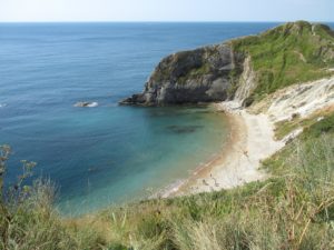
The view of Man O’War Cove as you approach from the car park. Durdle Door is on the other side of the headland, off to the right of the photo.
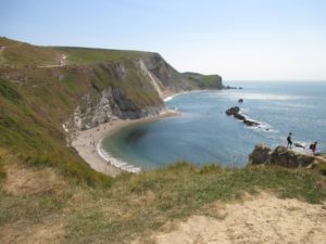
Man O’ War Cove is the nearer of the two bays: all together this is St Oswald’s Bay. The rocks in the sea are Man O’War Rocks, and the promontory separating the two coves is Man O’War Head. Looking to the east.
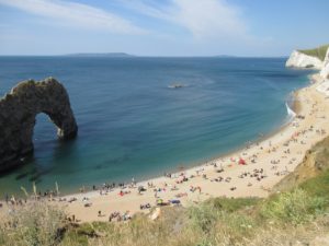
Durdle Door, with the high ground of the Isle of Portland (not actually an island) in the background to the left, and Weymouth in the background to the right.
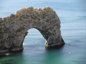
Durdle Door. Some lads were climbing up the right hand part of the arch and jumping off into the sea – you can make them out if you enlarge the photo.
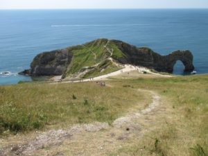
We climbed up a footpath back to the car park, and were rewarded with this fabulous view of the headland: Man O’War Cove on the left and Durdle Door on the right.

All the time we were there was a constant stream of green t-shirt clad walkers was coming from the west. They were all taking part in the Macmillan Cancer Support Jurassic Coast Mighty Hike, a 22-mile walk along the coast to raise sponsorship funds for this fantastic charity.
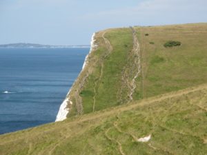
Green-clad charity walkers for the Mighty Hike organised by Macmillan Cancer Care. The walkers were doing a 22-mile walk in the scorching heat – much respect!

If you are interested in the geology of the area, this illustrated article is a good place to start.
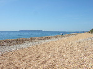
Sunday stroll: Portland Bill

Today we went for a walk at Portland Bill, the most southerly point on the Isle of Portland. The Isle of Portland is a strange place, hanging off the bottom of Chesil Beach like a stony teardrop. The island is an outcrop of Jurassic limestone which has been valued as a building stone for centuries. If you know the Tower of London: that’s Portland Stone. And St Paul’s Cathedral. And Buckingham Palace. And the United Nations headquarters building in New York City. And the Auckland War Memorial Museum in New Zealand. I could go on …

The Isle of Portland seen from Ringstead Bay on a sunny summer's day. To the right of the photo is Weymouth.

The Isle of Portland seen from Ringstead Bay on a sunny summer’s day in 2012. To the right of the photo is Wyke Regis, near Weymouth. Chesil Beach – a narrow spit of land, or tombolo – joins the two.

Quarrying has created a weird and atmospheric landscape on the island, with worked-out quarries and others that are still in use, and piles of discarded, sub-standard stone and workings piled in heaps and dumped over the edges of the high cliffs.

At the southerly end of the island is Portland Bill, with its two lighthouses to warn ships of the rocks and the deadly currents – the Race – where the water of the English Channel churns around the tip of the island in a furious boiling wash of water. Pulpit Rock is all that remains of a stone arch that was cut away by quarrymen.

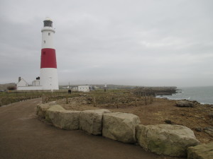
Portland Bill lighthouse.

Portland Bill lighthouse, and the other lighthouse (once the home of Marie Stopes) visible in the mid distance.

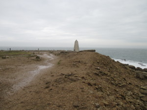
The Trinity House Obelisk, a daymarker to warn shipping off the coast during the day.

The Trinity House Obelisk, a daymarker to warn shipping off the coast during the day. All the land in the foreground is made ground, waste dumped by the quarrymen in centuries past.

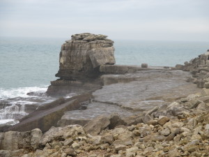
Pulpit Rock.

Pulpit Rock.

It was a mild and windy day, and we scrambled down to a sea ledge to have a look at the stone and the seascape better.

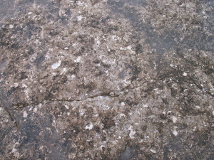
Fossilliferous limestone exposed on the ledge by Pulpit Rock.

Fossiliferous limestone exposed on the ledge by Pulpit Rock.

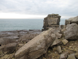
Dumped rejected stone near Pulpit Rock. The black dot on the water is a cormorant - we watched it repeatedly dive for food.

Dumped, rejected stone on a waste heap near Pulpit Rock. The black dot on the water is a cormorant (Phalacrocorax carbo) – we watched it repeatedly dive for food.

Earlier in the day we had been in Weymouth looking for jewellery goodies for my Etsy shop, and met this fellow in the car park:

Herring gull on the bonnet of our car in Weymouth.

Herring gull (Larus argentatus) on the bonnet of our car in Weymouth.