Archives

The Piet Oudolf garden at Hauser & Wirth, Bruton

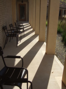
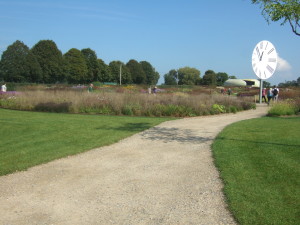
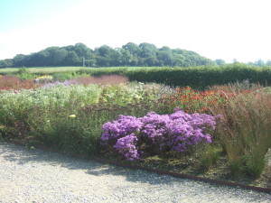
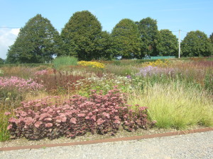
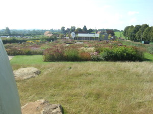
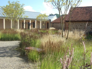
We had a look round here on Saturday. The old farm buildings have been beautifully restored and altered for use as a gallery exhibition space, and new buildings have been added. My favourite part was the modern cloister, with clever planting. I assume the planting is by Piet Oudolf, who designed the beautiful meadow garden behind the gallery. The gallery and gardens are free to enter. The next exhibition there is one of photos by Don McCullin.

DSCF4566

DSCF4569

DSCF4570

DSCF4573

DSCF4572

DSCF4583

DSCF4586

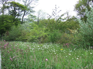
The late summer prairie-style planting was looking spectacular, and the garden was alive with bees and butterflies and hoverflies and dragonflies and damselflies and other assorted bugs and beasties. I think any beekeepers round there must be delighted!

Hauser & Wirth Somerset website

Sunday stroll: Down through Dorset

Not really so much a stroll as a bimble in the car with a short walk at the end of it. Chap and I headed for the seaside yesterday, taking a long and slow route through Somerset and Dorset’s winding country lanes.

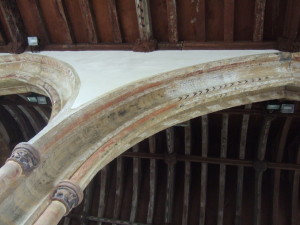
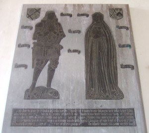
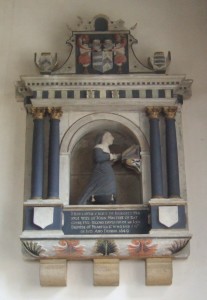
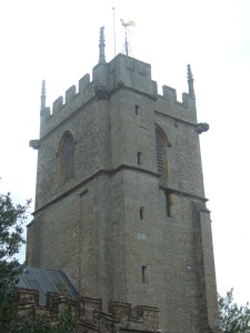
We stopped off at several places en route. First stop was the church of St Andrews in Yetminster. Here we admired the 15th-century painted decoration still surviving on the stonework and woodwork and a reminder of how our mostly now-plain parish churches would have looked in the past. There was a splendid brass monument to John Horsey (died 1531) and his wife on one wall, and another, stone this time, to Bridgett Minterne, who died in 1649. While we were there we were surprised by the church bells, which rang out ‘God Save the Queen’ – very unexpected. Apparently this happens every three hours to remind the villagers of Queen Victoria’s Jubilee in 1897. I wonder if it happens through the night? There are some fantastic gargoyles on the tower, and a beautiful golden weathercock, but my photos of these haven’t come out very well and so don’t do them justice.

x

15th-century painted decoration at St Andrew’s, Yetminster.

x

Brass monument to John Horsey (died 1531) and his wife, St Andrew’s, Yetminster.

DSCF4335 (2)

Monument to Bridgett Minterne (died 1649), St Andrew’s, Yetminster.

x

The tower with gargoyles and golden weathercock, St Andrew’s, Yetminster.

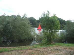
Next stop was the reservoir at Sutton Bingham. We went for a short walk along the edge of the reservoir through the wildflower hay meadow that is managed by Wessex Water, but as it had been given its annual cut not too long ago there wasn’t much to see. On the water there were mainly gulls and a few ducks, and a heron perched on the opposite shore. Sadly we didn’t see the osprey that are summer visitors here. A few dinghies and sailboats from the yacht club were pootling up and down the water, all very Swallows and Amazons.

A Mirror dinghy on Sutton Bingham Reservoir.

A Mirror dinghy on Sutton Bingham Reservoir.

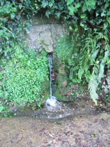
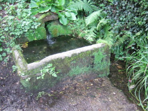
Then down into deepest Dorset and the Marshwood Vale. We stopped at the village of Stoke Abbott, parking near a lovely lion’s-head fountain of spring water with a spring-fed stone trough for horses nearby, both under a mighty oak planted in 1901 to celebrate the accession of Edward VII to the throne following the death of Victoria. We wandered off to look at the church of St Mary the Virgin. There had been a wedding there recently, as the fresh and dried flower confetti lay on the path and the church was still adorned with the wedding flowers. The church is in such a pretty setting, and has a 12th-century font with wonderful carvings.

x

Lion-headed fountain for spring water at Stoke Abbott.

x

Spring-fed water trough for horses, Stoke Abbott.

x

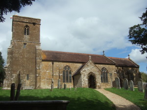
St Mary the Virgin, Stoke Abbott.

x

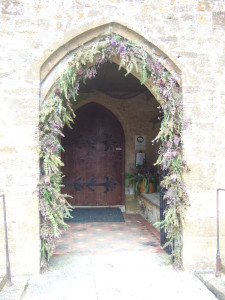
Wedding flowers at the porch, St Mary the Virgin, Stoke Abbott.

x

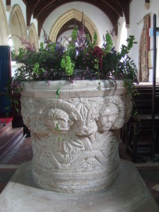
The 12th-century font, St Mary the Virgin, Stoke Abbott.

x

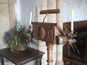
Wedding flowers and the simple lectern, St Mary the Virgin, Stoke Abbott. The flowers included agapanthus and Mollucella laevis (Bells of Ireland).

x

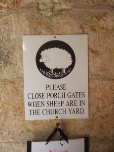
Notice in the porch, St Mary the Virgin, Stoke Abbott.

x

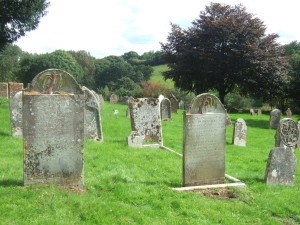
The sadly sheep-free graveyard, set in the most beautiful countryside, St Mary the Virgin, Stoke Abbott.

x

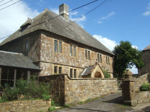
A lovely thatched house near the church in Stoke Abbott.

When we got back to the car a family (grandparents and wee granddaughter, we guessed) were filling up a car boot-load with numerous bottles and containers of the spring water, so I assume it’s safe to drink.

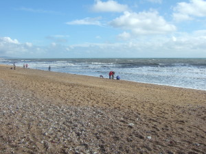
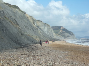
After a fruitless search for the cottage in Ryall where my family had spent several summer holidays in the late 60s (Mr and Mrs Kinchin’s B&B), we headed for the sea at nearby Charmouth. The weather was wild and windy, and we had a chuckle over the couple braving it out with their windbreak and deck chairs. We watched a kestrel quartering the top of the landslip cliffs, searched in vain for fossils, walked a short way up the beach and then decided to head home, via Bridport, Dorchester and Shaftesbury. We are so lucky to live in such a beautiful part of the world.

x

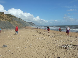
A blustery afternoon at Charmouth.

x

No-one in the water, unsuprisingly.

The well-named Golden cap on the right.

The well-named Golden Cap on the right.

The shell grotto at St Giles House

One of the nominations for the recent prestigious Historic England Angel Awards was for the craftsmanship in the restoration of the shell grotto at St Giles House near Wimborne St Giles in Dorset. Chap and I were very disappointed when it didn’t win – we thought it deserved the title, but then again, we are a little biased as we know the team from Sally Strachey Conservation that undertook the work.

The grotto is featured in the video above, from 2:10 onwards.

The grotto was built in the grounds of St Giles House, the family seat of the Earls of Shaftesbury. It dates from the early 1750s, and was built by John Castles (d. 1757) of Marylebone in London. Unlike some other grottoes, this one is free-standing rather than built into a rock face or hill slope, and is built over a springhead in the grounds. It is now safely roofed once more and even though it is not quite ordinary-looking from the outside, nothing prepares you for the fantastical realm within.

The grotto comprises an entranceway leading to a central room – the inner chamber – with tiled floor and a fireplace. This is flanked on either side by a curving side passage.

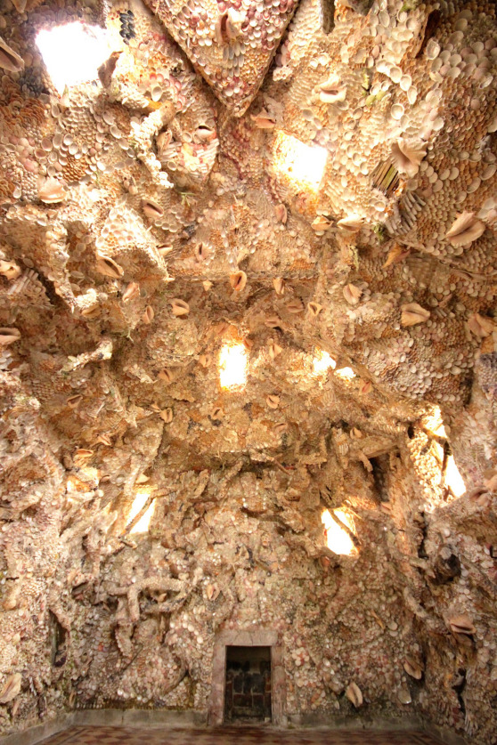
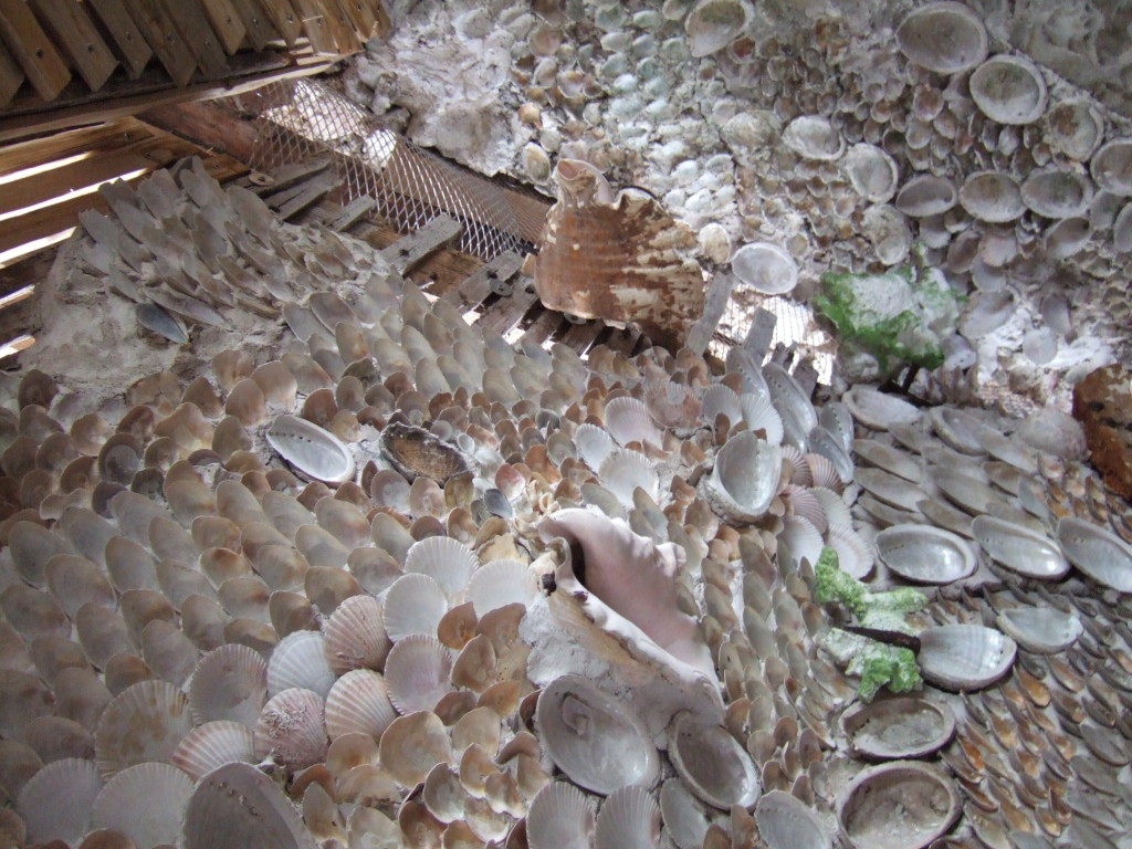
The main room is described in the Shell Guide to Dorset by Michael Pitt-Rivers (1966) as ‘an attempt at an underwater room rather than just a shell room’, and you certainly get the sense of being in some mysterious and magical undersea kingdom. The decoration comprises shells of all sorts of kinds, sizes and colours – huge conches are fixed to the walls as well as tiny jewel-like bivalves – and the marine effect is heightened by the clever way corals and sparkling mineral crystals, such as quartz, have been incorporated in the decor, as well as the way the shells have been attached to branches to mimic life in a coral garden. (You wouldn’t know there are branches under there, as they have been fully covered).

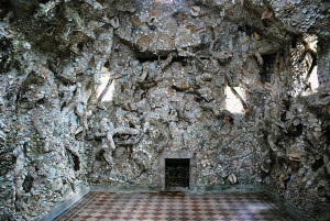
The main chamber of the shell grotto at Wimborne St Giles. Photo by SPAB.

The main chamber of the shell grotto at Wimborne St Giles, following the recent restoration work. Photo by SPAB.

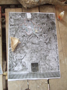
Old photo of the grotto used by the conservators as a guide.

Old photo of the grotto before it fell into disrepair, used by the conservators as a guide.

Apparently some of the original shells came from the Caribbean, courtesy of the father of William Beckford of Fonthill Abbey: we know Fonthill and its grottoes well. In the restoration many of the shells had fallen from the walls and part of the work included sifting and storing those that could be saved. Replacement shells were sourced from all over, including eBay and beaches!

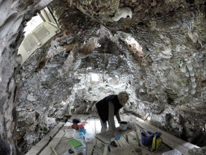
Repair work under way, rebuilding the shells on to the lath and plaster work.

Conservation work under way, rebuilding the shells on to the lath and plaster work.

Conservation work underway.

Conservation work under way. Photo by Sally Strachey Conservation.

Photo by Sally Strachey Conservation.

The main chamber after the completion of the conservation project. Photo by Sally Strachey Conservation.

We were impressed with how meticulous and intricate the work was, and the great care that was being taken by the team.

The side passages are mainly decorated with huge, knobbly flint nodules, though hiding in amongst these are the occasional whale vertebra and piece of architectural stone. The floors of the passages are set with smaller flint pebbles, much like the wonderful grotto at Stourhead and the much smaller one at the Larmer Tree Gardens.

The grotto is described as ‘recently restored’ in the 1966 Shell Guide; clearly it fell back into disrepair not long afterwards as by the time of its listing by English Heritage in 1986 it is described as ‘overgrown and in a state of dereliction … The main grotto which cannot now be easily entered has walls lined with shells, fossils, coral and stone mounted on a lathe and plaster vault, partially collapsed … An important example of this type of grotto but now in a state of considerable disrepair.’ It was placed on the English Heritage Buildings at Risk Register, and its fate looked bleak.

However, in the past few years the present Earl of Shaftesbury instigated a sizeable programme of works to save not just the grotto, but St Giles House itself, which was also on the Register. The work was largely funded by various government bodies. The work done on the house won the Earl and Countess of Shaftesbury the Award for the Best Rescue of Any Other Type of Historic Building or Site at the recent Angel Awards.

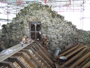
Repairing the roof.

Repairing the roof of the grotto.

Huge congratulations to everyone involved in the work, both at the grotto and St Giles House, both of which are now firmly off the Register.

If you want to know more about John Castles’ grotto work, this blog post is an interesting place to start.

Further information and reading

The English Heritage Grade 2* listing of the grotto

Sally Strachey Conservation page about the project

A blog post about a SPAB visit to the grotto while the restoration work was underway last summer

RCHM (Royal Commission on Historical Monuments), Dorset vol V, 1972, p. 97, no. 6.

Newman, J and Pevsner, N, The Buildings of England: Dorset, 1972, p. 473.

Pitt-Rivers, M,  Shell Guide to Dorset, 1966, p. 141.

Jones, B, Follies and Grottoes, 1953, pp. 47-49.

Sunday stroll: Larmer Tree Gardens

Yesterday we headed out to visit the Larmer Tree Gardens, near Tollard Royal in south Wiltshire. These beautiful Victorian gardens have the distinction of being the first privately owned gardens in the UK that were opened for the enjoyment of the general public.
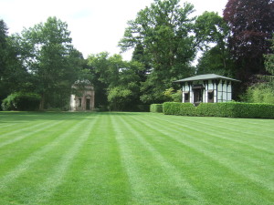
The Larmer Tree Gardens: the Temple on the left and the General's Room on the right.

The Larmer Tree Gardens: the Temple on the left and the General’s Room on the right.

The gardens are on the Rushmore Estate, which is in the ownership of the Pitt Rivers family. In 1880 Augustus Pitt Rivers inherited the estate, and started work almost immediately on the gardens, the development of which continued over the entire 20 years that the gardens were open.
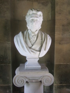
Bust of Augusts Pitt Rivers in the Temple at the Larmer Tree Gardens.

Bust of Augustus Pitt Rivers in the Temple at the Larmer Tree Gardens.

The gardens became a massive attraction, at one point entertaining 44,000 visitors a year. Thomas Hardy visited, and even wrote a poem celebrating an evening spent there. The gardens closed with the death of Pitt Rivers in 1900, and gradually fell into disrepair.
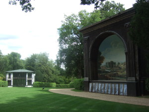
The Lower Indian Room (left) and the Singing Theatre (right) at the Larmer Tree Gardens.

The Lower Indian Room (left) and the Singing Theatre (right) at the Larmer Tree Gardens.

The central lawn area is surrounded by various structures and buildings; others are set further back in the gardens, linked to the central lawn by wide grass paths flanked by cherry laurel hedges. These hedges also enclose several small picnicking areas, all part of Pitt Rivers’ design to allow the maximum enjoyment of the gardens by his estate workers and the general public. Around the edges of the garden are woodland areas and a few herbaceous beds. However, it is the buildings around the lawn that characterise this extraordinary garden, though the free-roaming peacocks and macaws are pretty iconic too.
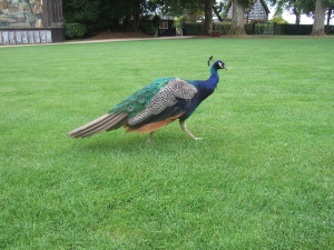
Free-roaming peacock at the Larmer Tree Gardens. In the background are the Singing Theatre (left) and the Lodge (right).

Free-roaming peacock at the Larmer Tree Gardens. In the background are the Singing Theatre (left) and the Lodge (right).

By the entrance gate at the southern edge of the gardens is the Lodge, which now houses the cafe and a private residence. Next to this around the lawn is the magnificent Singing Theatre, with its wooden structure and painted backdrop. The paintwork is peeling and faded, and mercifully the theatre hasn’t been restored from its gently and elegantly ageing state.
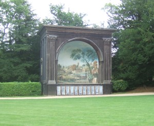
x

The Singing Theatre at the Larmer Tree Gardens.
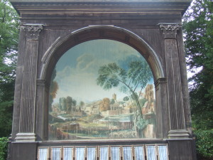
The Singing Theatre at the Larmer Tree Gardens.

The Funeral of Phocion by Nicolas Poussin (1648).

The Funeral of Phocion by Nicolas Poussin (1648), the painting on which the Singing Theatre painted backdrop is based.
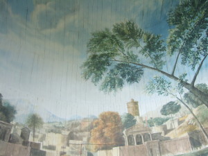
Detail of the painted backdrop: you can clearly see the curved boards onto which the painting has been made.

Detail of the painted backdrop: you can clearly see the boards onto which the painting has been made.
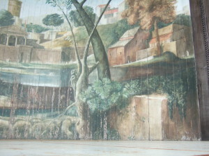
Detail of the painted backdrop.

Detail of the painted backdrop. There are three doors hidden in the painting: one at the back and one at either side.

Next is the Lower Indian Room, and then the General’s Room. Both of these are traditional Indian buildings transposed to a bucolic English setting.
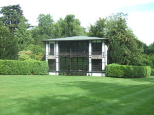
The Lower Indian Room

The Lower Indian Room at the Larmer Tree Gardens, with peahen resting on the front verandah.
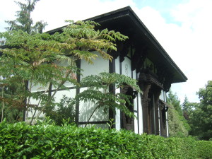
The General's Room at the Larmer Tree Gardens.

The General’s Room at the Larmer Tree Gardens.
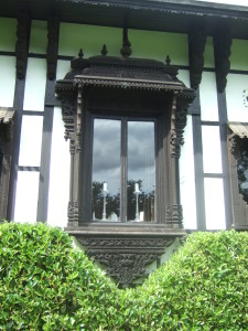
Detail of a window of the General's Room at the Larmer Tree Gardens.

Detail of an intricately carved window of the General’s Room at the Larmer Tree Gardens.

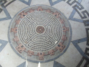
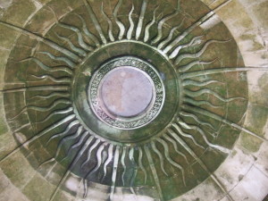
The final building around the lawn is the Temple, a beautiful small stone building in the Palladian style. It has a fireplace and a beautiful floor (including a maze mosaic) and decorative ceiling, and I can so easily picture Augustus sitting there with his pipe, reading a tome or working on his archaeological notes.
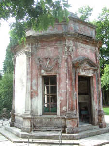
The Tenple at the Larmer Tree Gardens.

The Temple at the Larmer Tree Gardens. The reddish hue on some of the stonework is due to lichen.
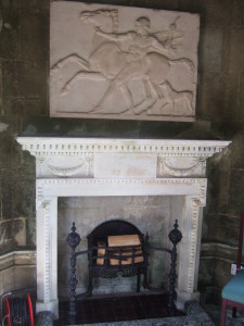
The white marble fireplace in the temple at the Larmer Tree Gardens.
The white marble fireplace in the temple at the Larmer Tree Gardens.

The maze mosaic in the floor of the Temple at the Larmer Tree Gardens.
The maze mosaic in the floor of the Temple at the Larmer Tree Gardens.

Domed stone ceiling with carved sun-ray motif in the Temple at the Larmer Tree Gardens.

Domed stone ceiling with carved sun-ray motif in the Temple at the Larmer Tree Gardens.

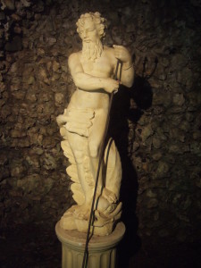
A steep flight of steps lead down from the Temple to a series of ornamental ponds with small waterfalls, with a small grotto complete with statue of Neptune complete with trident.
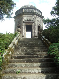
The Temple at the Larmer Tree Gardens.
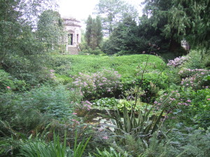
The Temple at the Larmer Tree Gardens.

View of the Temple across the ornamental ponds at the Larmer Tree Gardens.
View of the Temple across the ornamental ponds at the Larmer Tree Gardens.

Neptune in his flint nodule-lined grotto at the Larmer Tree Gardens.

Neptune in his flint nodule-lined grotto at the Larmer Tree Gardens.

Further behind the central lawn are two small thatched wooden shelters, Band View and Stag’s Arbour, and the corrugated iron-clad Jubilee Hall, built to celebrate the 50th anniversary of the reign of Queen Victoria.

Following Augustus Pitt Rivers’ death, the gardens were neglected, with the cherry laurels gradually taking over and swamping the carefully-maintained paths and small picnic gardens, and the buildings slowly falling into disrepair, with some rotting away all together: the octagonal base of the bandstand is still visible by the lawn, and another building base on the opposite side near the Singing Theatre. The restoration was started in 1991, and the gardens reopened in 1995.

The gardens have a wonderful atmosphere. There are deck chairs available for visitors’ use, as well as a croquet set, apparently. Peacocks roam freely throughout the gardens: the lady in the cafe told us that one of the peahens had two chicks, but we didn’t spot them. The males have lost their glorious tail feathers in their annual moult, but were still very spectacular.
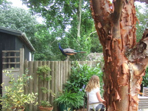
A canny peacock lurking at the cafe garden at the Larmer Tree Gardens. Lovely bark on the Acer griseum tree in the foreground.
A canny peacock lurking at the cafe garden at the Larmer Tree Gardens. Lovely bark on the Acer griseum tree in the foreground.

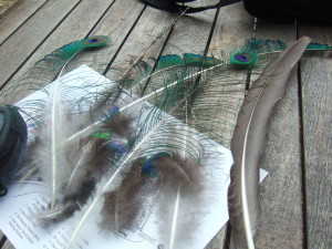
My haul of shed peacock feathers.

My haul of shed peacock feathers.

And we loved seeing the pair of macaws sitting in an ash tree: such an unexpected sight for an English country garden!
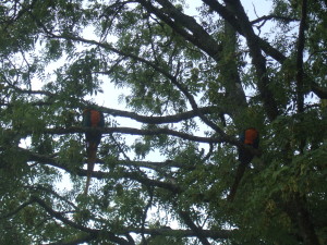
Spot the macaws!

Macaws in an ash tree at the Larmer Tree Gardens.

They are totally free to come and go as they please, and apparently are often seen at the nearby Rushmore Golf Course.

An extra treat for children (and the young at heart) visiting the gardens are the eleven fairy doors hidden in the base of trees the gardens. We found three:
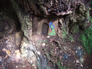
Peacock fairy door at the Larmer Tree Gardens.
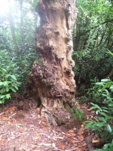
Peacock fairy door at the Larmer Tree Gardens.
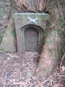
x

Peacock fairy door at the Larmer Tree Gardens.

Scottish fairy door in a Western Red Cedar at the Larmer Tree Gardens.
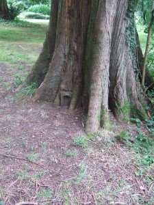
Scottish fairy door in a Western Red Cedar at the Larmer Tree Gardens.
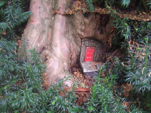
Scottish fairy door in a Western Red Cedar at the Larmer Tree Gardens.

Scottish fairy door in a Western Red Cedar at the Larmer Tree Gardens.

Red fairy door in a yew tree at the Larmer Tree Gardens.
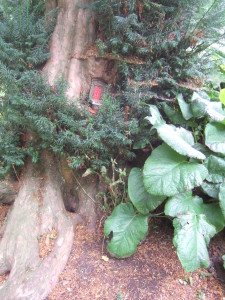
Red fairy door in a yew tree at the Larmer Tree Gardens.

Red fairy door in a yew tree at the Larmer Tree Gardens.

Red fairy door in a yew tree at the Larmer Tree Gardens.

Luckily there’s a fairy door trail leaflet to help you find them all.

A little way away from the gardens is a massive and very strange Indian-style folly. We walked over to it: it is in the middle of a field, surrounded by quite a deep ditch, and there is a ride cut through the trees to allow a vista of the folly from King John’s House in Tollard Royal. Pitt Rivers owned King John’s House, a 13th century manor house.
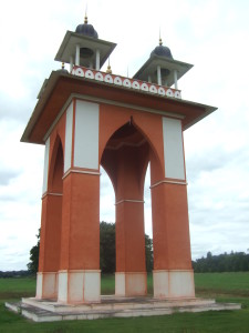
The Indian-style folly near the Larmer Tree Gardens.

The Indian-style folly near the Larmer Tree Gardens.

The gardens are open at a small charge (currently £4 for an adult). Unsurprisingly they are a favourite venue for weddings, and there are also a couple of festivals held there each year (the Larmer Tree Festival and the End of the Road Festival). Consequently there are often times when the gardens are closed: I have driven to it quite a few times now only to be disappointed. Needless to say it’s highly recommended to check opening days and times online first!

I always think of the gardens being in Dorset rather than Wiltshire, possibly because Pitt Rivers is so inextricably linked with his groundbreaking archaeological work in Cranborne Chase in Dorset; looking at the 1:25,000 OS map of the area I see that the county boundary between Wiltshire and Dorset actually runs along the southern edge of the gardens. Unusual to park our car in Dorset to visit a garden in Wiltshire!

Timeline of the development of the garden buildings:

* 1880 The Temple

* 1881 The Lodge

* 1882 Stag’s Arbour

* 1886 Band View

* 1895 The Singing Theatre; The Larmer Tree studio attached to the Lodge

* 1896 Jubilee Hall

* 1897 Lower Indian Room

* 1899 The General’s Room

Can't resist it: I'm not a grily girl by any strecth of the imagination (I wear a dress about twice a year), but look at this gorgeous dress on a bride at the Larmer Tree Gardens.

Can’t resist it: I’m not a girly girl by any stretch of the imagination (I wear a dress about once a year), but look at this gorgeous gown on a bride at the Larmer Tree Gardens.

Larmer Tree Gardens website.
St Mary’s Church, Old Dilton

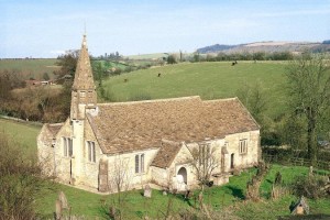
One of the things Chap and I love to do is to visit parish churches. There are some that strike a particular, atmospheric chord: redundant churches that are no longer used for worship. A good number of these churches are looked after by the Churches Conservation Trust. One of our favourites is not too far from where we live: St Mary’s Church at Old Dilton, near Westbury in Wiltshire. We love old buildings, and this one is a beauty.

WiltshireOldDiltonStMaryextmain

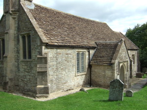
St Mary’s Church, Old Dilton, Wiltshire.

This is a 14th century church situated in a quiet, out-of-the way spot near the River Biss. The community it originally served, Dilton, was a thriving wool-producing settlement, with houses, a mill and the church. However, with the decline of the woollen industry in the 17th century, the village became eclipsed by the new, thriving settlement of Dilton Marsh some 2.5 km to the north, and the much-reduced Dilton became known as Old Dilton.

With the shrinking community, St Mary’s church struggled after the new church was built at Dilton Marsh in 1844. In 1956 St Mary’s was closed for congregational use, and remained in the care of the parish until 26 April 1973, when it was declared pastorally redundant. In 1974 it was vested in the care of the then-Redundant Churches Fund (now the Churches Conservation Trust).

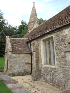
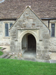
The church’s plan is very simple, with a 14th century porch that might be a survivor of an earlier church; the main body of the building dates from the 15th century.

x

St Mary’s Church, Old Dilton: the spire and south porch.

aDSCF0280 (1)

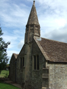
St Mary’s Church, Old Dilton: the stumpy spire at the west end of the church.

The 14th century porch.

St Mary’s Church, Old Dilton: the 14th century porch.

x

St Mary’s Church, Old Dilton.

View from the road of the north side of the church.

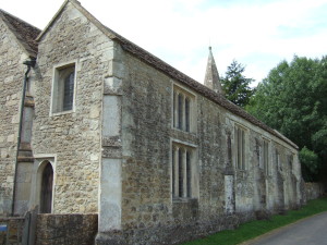
St Mary’s Church, Old Dilton: view from the road of the north side of the church.

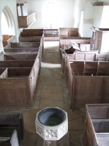
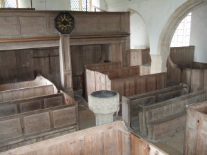
Inside, there is no division between the nave and the chancel. The nave is filled with 18th century box pews, some of which are built to incorporate medieval benches. The triple decker pulpit dominates the south side of the nave.

Looking from the west end towards the chancel. The font is a 19th century copy of a 15th century font.

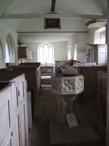
St Mary’s Church, Old Dilton: looking from the west end towards the chancel.  The triple decker pulpit is on the right (south side of the church). The font is a 19th century copy of a 15th century font.

The interior of the church, looking towards the gallery at the north end. The triple decker pulpit is on the left (the south side of the nave).

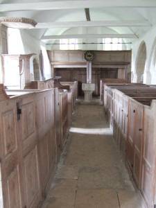
St Mary’s Church, Old Dilton: the interior of the church, looking towards the gallery at the west end.

Over the northern side of the chancel is a gallery, which was used as a schoolroom, and which is accessed by a separate door on the outside of the church. Another gallery is situated at the western end of the nave. The chancel has a very long and simple communion table, dating from the 17th century. The plain glass in the windows is modern, replacing what would have been the medieval coloured glass.

View from the west gallery of the chancel and the gallery on the north side of the church.

St Mary’s Church, Old Dilton: view from the west gallery of the chancel with its plain communion table and the gallery on the north side of the church.

The west gallery and box pews.

St Mary’s Church, Old Dilton: view from the pulpit of the west gallery and box pews.

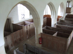
The nave aisle on the north side of the church.

St Mary’s Church, Old Dilton: the nave aisle on the north side of the church, and horribly incongruous fire extinguisher.

St Mary’s has no electricity, and so no intrusive modern light fittings. At Christmas, candlelit services are held. They must be extremely beautiful. I have always wondered whether St Mary’s has been used as a filming location for a period piece, as the marks of the modern world on it are so light, but haven’t yet found anything to suggest that it has. It is certainly a very atmospheric and special place. Chap and I were lucky enough to do some work on the conservation of this church a few years ago: masonry work, replastering and limewashing.

Sadly the church has to be kept locked (a depressing sign of the times). The key is held by a neighbouring householder: details are on one of the church doors.

Sources:

The Church of the Blessed Virgin Mary, Old Dilton, Wiltshire Neil Skelton, 1986, Redundant Churches Fund.

Churches Conservation Trust website.

Sunday stroll: Fontmell Down

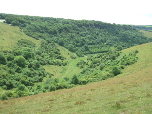
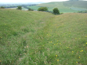
Yesterday Chap and I headed off to the main part of Fontmell Down Nature Reserve, which is run by Dorset Wildlife Trust and situated about 5 km south of Shaftesbury in Dorset. Fontmell Down is a spur of chalk downland jutting out above the Blackmore Vale. The spur is bisected by two cross dykes, landscape features that are likely to date from the Middle Bronze Age. We visit this reserve often, but it is at its beautiful best this time of the year, we reckon. Click on all photos to embigggen/bigify.

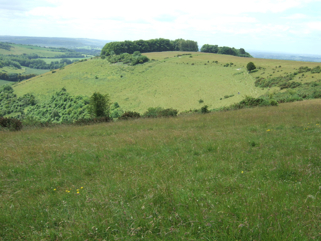
The spur of Fontmell Down, part of the chalk downland above the Blackmore Vale in Dorset.

The spur of Fontmell Down, part of the chalk downland above the Blackmore Vale in Dorset. The northern cross dyke is clearly visible, just in front of the woodland on the spur. The southern one is obscured by the wood.

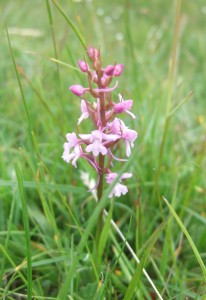
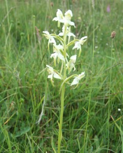
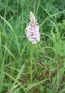
The orchids are out and within a few minutes of being on the reserve we’d seen five different species: bee, common spotted, fragrant, pyramidal and the greater butterfly orchid.

x

Fragrant orchid (Gymnadenia conopsea).

x

Greater butterfly orchid (Platanthera chlorantha).

x

Common spotted orchid (Dactylorhiza fuchsii).

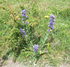
Viper’s bugloss (Echium vulgare) is such a pretty flower. It is a glorious blue, and beloved of moths and butterflies and bees. It doesn’t grow very high on the thin soil of the chalk downland, but I have seen it growing up to about 80 cm tall.

x

Viper’s bugloss (Echium vulgare).

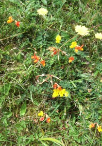
We also saw milkworts (Polygala sp.) in pink and in blue, and the wonderfully vibrant flowers of birdsfoot trefoil (Lotus corniculatus). We always called this ‘the eggs and bacon plant’ when we were kids, for obvious reasons!

aDSCF7055 (2)

Birdsfoot trefoil (Lotus corniculatus).

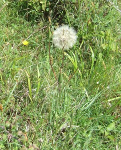
There were also the enormous seedheads of goatsbeard (Tragopogon pratensis), like dandelion clocks on steroids. Goatsbeard flowers only open on sunny mornings, so the flower gained the charming folk name of Jack-go-to-bed-at-noon.

x

Goatsbeard (Tragopogon pratensis).

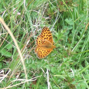
It was a rather blustery day, so we didn’t see too many butterflies, but we did see some fritillaries and a rather tatty painted lady (Vanessa cardui), as well as various blues and skippers.

x

A fritillary. I’m not very good on butterflies, but think this might be a dark green fritillary (Argynnis aglaja).

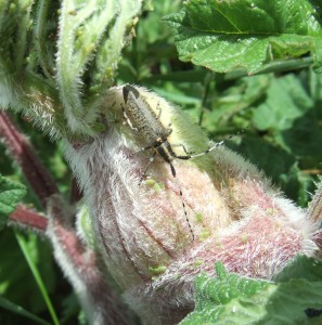
We also saw this chap – isn’t he wonderful? No idea what he is.

x

Mystery beetle with the most dashing striped antennae.

The beautiful down has a deep coombe on its southern side, Longcombe Bottom, with ravens flying over, cronking their atmospheric calls

x

Longcombe Bottom.

and there are stunning views to the south-west across the Blackmore Vale:

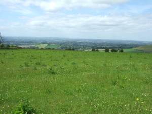
View looking south-east into Blackmore Vale, with the village of Fontmell Magna in the foreground of the vale.

View looking south-east into Blackmore Vale, with the village of Fontmell Magna in the foreground of the vale.

We also walked on down to a chalk pit hollow nearby, where there was the best show of orchids. Just common spotted and pyramidal, but so beautiful.

x

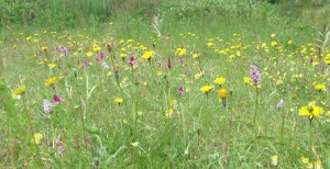
The orchids in the chalk pit hollow: pyramidal orchids (Anacamptis pyramidalis) and common spotted orchids (Dactylorhiza fuchsii). Definitely click on this one to embiggen/bigify – it’s worth it, I promise!

A water pipeline has recently been built across the reserve, and it was interesting to see the different flowers that have popped up in the disturbed area: lots of oilseed rape and common poppies and thistles, whereas the undisturbed land was mainly cow parsley and nettles.

x

The different flora marks the recent pipeline disturbance.

The northern cross dyke had more orchids than on the other parts of the down, because the ditch provides a sheltered microclimate.

aDSCF7006

Looking north-westwards down the northern cross dyke, with Melbury Hill in the background.

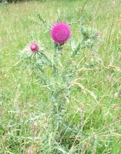
A beautiful thistle. Not sure which kind, but what a gorgeous colour.

x

A beautiful thistle on Fontmell Down Nature Reserve.

Sunday stroll: Tyneham and Worbarrow Bay

Yesterday Chap and I headed south, to Tyneham and Worbarrow Bay in the Purbeck Hills of Dorset.

Tyneham has a fascinating and rather sad history. For centuries it was a small, isolated village near the Dorset coast, its inhabitants subsisting mainly by agriculture and fishing. In 1943, the Army took over the area for training and preparations for the D-Day invasions, and this required the evacuation of the 225 inhabitants of Tyneham. They were given just 28 days’ notice. The villagers left, believing they would return after the war, but 72 years on they have not been allowed back to Tyneham, nor are they ever likely to be. The area is still used as an Army Firing Range, and access is limited.

The road down into Tyneham.

The road down into Tyneham.

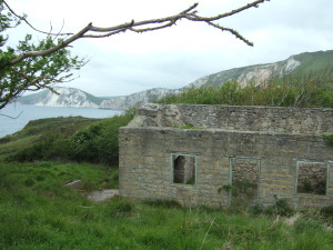
We have previously visited Imber, a similar deserted village on the Salisbury Plain Training Area, where the houses are closed up but well preserved. Tyneham is very different. All the buildings apart from the church and the school house are dilapidated, with roofs missing, no floors, no windows and generally in a really ruinous state: the once-beautiful family homes are now just shells.

The approach to the village. Army 'keep out' sign to the right of the road.

The approach to the village. Army ‘keep out’ sign to the right of the road.

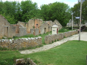
Row of four cottages. The village has been 'prettified' for the visitors: the pavement and kerbing postdate the village's abandonment.

Row of four cottages, and an old phone box. The village has been ‘prettified’ for the visitors: the pavement and kerbing postdate the village’s abandonment.

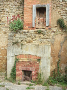
Fireplaces inside on of the cottages.

Fireplaces inside one of the cottages.

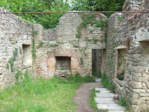
Another ruined cottage. The tie bars are holding the walls upright - without the roof they have started to spread quite markedly.

Another ruined cottage. The tie bars are holding the walls upright – without the roof they have started to spread quite markedly.

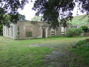
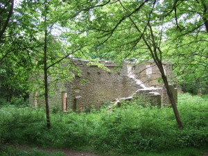
The Rectory.

The Rectory.

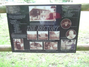
Noticebaord at the Rectory. The photo shows that it was once a beautiful Georgian building.

Noticeboard at the Rectory. The photo shows that it was once a beautiful Georgian building.

A picturesuw ruin now. Since the village's abandonment, trees have grown where would once have been beautifully-tended gardens.

A picturesque ruin now. Since the village’s abandonment, trees have grown where would once have been beautifully-tended gardens.

It really brings it home to you on a visit to Tyneham how much a community is about the place as well as the people. And when the people were moved away from the place they loved, and settled in different locations, their community died.

The last villagers to leave pinned a poignant note to the door of the church:

download

Sadly the houses were not treated with care. I don’t know whether Tyneham itself was used for target practice, as were and are the surrounding hills, or quite how they came to be so ruinous in such a short period. Certainly the Army is trying to keep them from further decay, but in general their repairs are very unsympathetic to the fabric of the old buildings, with hard Portland cement being used rather than lime mortar, and infills and repairs made with engineering bricks and cement. I know the Army is not a conservation body, but it is so sad to see the buildings as they are.

v

View on the way down to Worbarrow Bay.

v

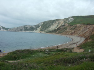
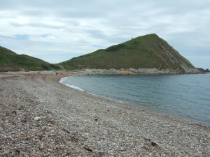
Worbarrow Bay. Lots of landslips round here.

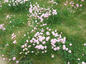
Thrift or Sea pink (Armeria maritima).

Thrift or Sea pink (Armeria maritima).

Bulbarrow Tout, and a party of kayakers who pulled up on the beach.

Worbarrow Tout, and a party of kayakers who pulled up on the beach.

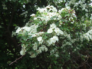
May blossom. The hawthorn flowers certainly look nicer than they smell! (Crataegus monogyna).

May blossom. The hawthorn flowers certainly look nicer than they smell! (Crataegus monogyna).

A pretty small area of meadow planted at Tyneham Farm barn.

A pretty small area of meadow planted at Tyneham Farm barn.

v

Another abandoned farm on the way out of Tyneham.

We drove past this on our (circuitous) way home: the Osmington White Horse, a hill figure created in 1808, and 85 m (280 feet) long and 98 m (323 feet) high.

We drove past this on our (circuitous) way home: the Osmington White Horse, a hill figure created in 1808, and 85 m (280 feet) long and 98 m (323 feet) high.

Tyneham and Worbarrow Bay are open to visitors at certain times: check the visitors page on the Tyneham PC website for details.

Stourhead in May

Yesterday Chap and I took a day off work and spent the day at Stourhead with Elizabeth, a family friend of old, and her friend Sue. The day started gloomily, with dark lowering clouds and heavy rain showers. But we were so lucky: the sun came out and the rain held off, although the impressive clouds remained. Sue hadn’t visited Stourhead before, so it was a joy seeing her delight at meeting this stunning garden for the first time.

I’ll let the photos do the talking. Click on any to embiggen/bigify:

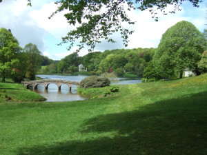
The Palladian Bridge and in the background, the Pantheon.

Stourhead: The Palladian Bridge and in the background, the Pantheon.

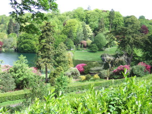
The view from the Temple of Apollo. The colours are so zingy at this time of year, and the rhododendrons and azaleas were looking amazing.

Stourhead: The view from the Temple of Apollo. The colours are so zingy at this time of year, and the rhododendrons and azaleas were looking amazing.

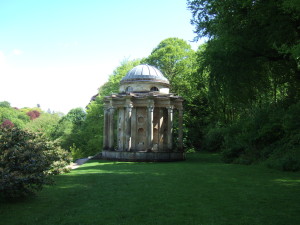
The Temple of Apollo. The lake is off to the left of shot.

Stourhead: The Temple of Apollo. The lake is off to the left of shot.

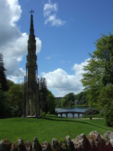
The Temple of Flora, the Palladian Bridge and the Bristol Cross photographed from outside the Pantheon.

Stourhead: The Temple of Flora, the Palladian Bridge and the Bristol Cross photographed from outside the Pantheon.

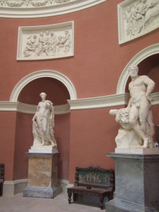
Inside the Pantheon.

Stourhead: Inside the Pantheon.

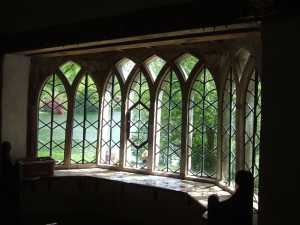
The deliberately wonky, shonky windows of the Gothic Cottage.

Stourhead: The deliberately wonky, shonky windows of the Gothic Cottage.

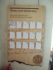
A memory board within the Gothic Cottage.

Stourhead: The memory board within the Gothic Cottage.

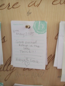
A lovely not pinned on the memory board

Stourhead: A lovely note pinned on the memory board. Ah, huge congratulations to Ben and Vicki.

Naughty Grace!

Stourhead: Naughty Grace!

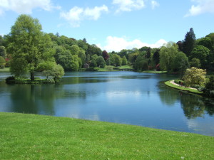
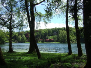
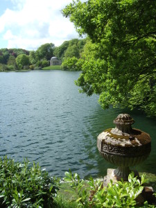
View across the lake to the Temple of Apollo.

Stourhead: View across the lake to the Temple of Apollo.

Gaudy rhododendrons and azaleas among the acers and other trees.

Stourhead: Gaudy rhododendrons and azaleas among the acers and other trees.

View from outside the Temple of Flora to the Pantheon.

Stourhead: View from outside the Temple of Flora to the Pantheon.

The Palladian Bridge from the Temple of Flora.

Stourhead: The Palladian Bridge from the Temple of Flora.

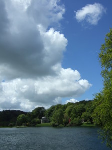
Stourhead: Big skies over the lake and the Pantheon.

Stourhead: Big skies over the lake and the Pantheon.

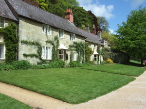
Cottages and the National Trust estate office at the village of Stourton, just outside the Stourhead landscape gardens.

Cottages and the National Trust estate office at the village of Stourton, just outside the Stourhead landscape gardens.

And this is the view from just by those cottages: the Bristol Cross, the Palladian Bridge and the Pantheon.

And this is the view from just by those cottages: the Bristol Cross, the Palladian Bridge and the Pantheon.

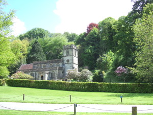
Stourton Church, viewed from the same spot as the previous photograph.

Stourton Church, viewed from the same spot as the previous photograph.

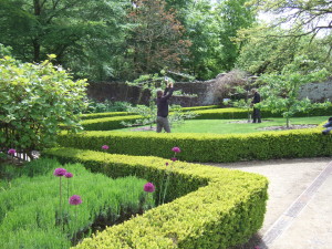
National Trust gardeners training some young fruit trees in the walled kitchen gardens.

Stourhead: National Trust gardeners training some young fruit trees in the walled kitchen gardens. Allium ‘Purple Sensation’ popping up between lavender within box hedges in the foreground.

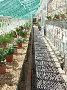
The restored glasshouse with the beautiful collection of species and variety pelargoniums.

Stourhead: The restored glasshouse with the beautiful collection of species and variety pelargoniums.

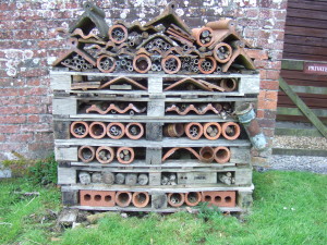
A wonderful bee, insect and other critter hotel made out of pallets, old terracotta roof tiles and ridge tiles and bamboo, among other things.

Stourhead: A wonderful bee, insect and small critter hotel made out of pallets, old terracotta roof tiles, ridge tiles and drainage pipes with bamboo, among other things, against a wall in the walled garden.

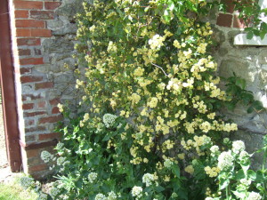
Rosa banksiae 'Lutea' growing against an outbuilding. Gorgeous.

Stourhead; Rosa banksiae ‘Lutea’ with its tiny yellow pompom flowers growing against an outbuilding. Gorgeous.

And watching the Chelsea Flower Show coverage on the Beeb yesterday evening after our return, what do I hear but architecture critic and broadcaster Tom Dyckhoff say this:

‘In fact, I would go so far as to say that the greatest contribution that Britain has made to worldwide design has been the landscape garden and its relationship to architecture. I mean particularly from the classic periods, the late 18th century, that kind of period of picturesque garden design, places like Stourhead. That was arguably our greatest design moment, certainly our greatest contribution.’

(edited slightly to remove ‘you knows’ and ‘like’s)

I couldn’t agree more. And we are so lucky to live so close and to be able to visit its wonders frequently.

National Trust visitor information for Stourhead.

Sunday stroll: Cold Kitchen Hill

It was a chilly and blustery day today, and we went on a lunchtime walk up on Cold Kitchen Hill, which rises above the Deverills in southern Wiltshire. The Deverills are a set of villages in the Deverill River valley which wends its way between between chalk downs, and there are five of them: Longbridge Deverill, Hill Deverill, Brixton Deverill, Monkton Deverill, and Kingston Deverill. We parked by Kingston Deverill Church, where we saw our first flowering snowdrops of the season in the churchyard.

Scattered snowdrops in the strangely headstone-free churchyard of Kingston Deverill church.

Scattered snowdrops in the strangely headstone-free churchyard of Kingston Deverill church.

Spring is definitely on its waythe birds are twittering and the buds are fattening. The cow parsley is starting to growit always strikes me how early in the season it gets going, but then again it has to be at full height and flowering by late April, so that’s not such a surprise really, I suppose. A raven cronked overhead as we walked away from the church.

As we walked along the road two racehorses were being unloaded from a horsebox and were ridden off. We followed the road to one of the many footpaths and bridleways that cross the hill, meeting the racehorses and their riders. Later, as we climbed the grassy slope, we could see them being ridden at a fair lick over the hill in the distance.

Looking south towards Kingston Deverill.

Looking south from the lower slopes of Cold Kitchen Hill, towards Kingston Deverill.

Looking eastwards from the lower slopes of Cold Kitchen Hill, looking up the valley towards Monkton Deverill.

From the same spot, looking eastwards up the valley towards Monkton Deverill.

A lovely flock of fieldfare, maybe fifty or so, flew over us, and reminded us of our lone visitor (he was still there this morning patrolling the lost gardenI check every day to see if he is still with us). We met a lady, flushed of face and runny of nose, with two serious looking walking sticks, and we stopped and had a natter. She hadn’t seen the fieldfare or the raven but introduced us to a wonderful new termcrookdawsfor flocks of indeterminate black corvids/mixtures of crows, rooks and jackdaws.

Lovely chalkdownland from Cold Kitchen Hill. The track is the Mid Wilts Way.

Lovely chalk downland from Cold Kitchen Hill.

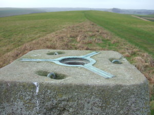
Then onwards and upwards. We startled a hare and it hared off, making a wide circle around us. We wandered over to the trig point on the summit (a mighty 257 metres above sea level). The trig points are built on high points around the country by the Ordnance Survey, the veritable surveying and mapping agency for the UK. The trig point (or trigonometry point, to give it its proper name) is a concrete obelisk with a flat upper surface, into which are set the fittings to accommodate the base of a theodolite.

The top of the trig point, showing attachment fittings for a theodolite. In the blurry middle distance is the beacon, a metal basket atop a high pole.

The top of the trig point, showing attachment fittings for a theodolite. In the blurry middle distance is the beacon, a metal basket atop a high pole.

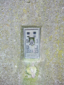
On the site of the trig point is a bench mark, the height of the top of the horizontal line of which is established in metres above sea level (m ASL). They are invaluable not only for map makers, but for archaeologists and architects and builders and surveyorsin fact, anyone who needs to know the absolute height of where they are. In our archaeologising days Chap and I frequently had to go hunting for bench marks. Their location is marked on OS 1:2,500 maps, along with their value in m ASL, and they are usually on buildings like churches or other structures that are assumed likely always to be there, and unlikely to be demolished.

The bench mark on the trig point on Cold Kitchen Hill.

The bench mark on the trig point on Cold Kitchen Hill.

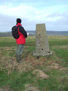
Anyhow, one of the basic features of a bench mark that it has to be level and unlikely to move, as of course this will alter its height and thus make any readings taken from it inaccurate. So we were somewhat amused by the appearance of the one on Cold Kitchen Hill. The ground at one side has been poached out into a hollow, presumably by cattle or sheep trampling there and resting against it, and so the whole thing leans at a drunken angle, making both the theodolite base and the bench mark, both of which need to be level to be of any use, rather useless.
Chap and the drunken trig point on Cold Kitchen Hill.

Chap and the drunken trig point on Cold Kitchen Hill.

In the distance we could see the beacon which had held the ceremonial bonfires that were last lit across the country in 2012 to celebrate the queen’s diamond jubilee, a rekindled (sorry, couldn’t help it) tradition that harks back to the days when the fastest method of transport was by horse, and so lighting fires in beacons on prominent hills was a far quicker way of relaying a message. Beacon Hill is a very common hill name in the UK, for just this reason. Beyond that, on the horizon, is Alfred’s Tower, a fantastic folly near Stourhead. In another direction we could see Duncliffe Hill and the escarpment on which Shaftesbury sits. And to the north-east was Salisbury Plain. Gliders were flying from the nearby Bath, Wilts and North Dorset Gliding Club.
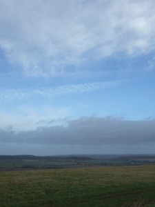
Beautiful skyscape, looking north from Cold Kitchen Hill towards Salisbury Plain.

Beautiful skyscape, looking NNE from Cold Kitchen Hill towards Warminster.

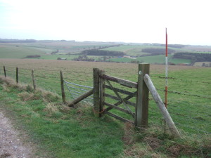
It was very windy and pretty coldthe kind of keen wind that makes your mandibles/ears ache, for some reason, so we headed back down the hill. We scared a lark from its roost in the grass, but it settled nearby very quickly. On the way we noticed an abandoned ranging rod in the fenceline by the Mid Wilts Way, the sort we have used many times on archaeological sites, for surveying and to serve as 2 metre scales in photographs. I assume it was left by a surveyor, possibly an archaeologist, and forgotten. It was a wooden one, which dates itmost are metal and come in two parts these days.

The abandoned ranging rod. Note the bottom hinge on the gate made of the farmer's best friend, baler twine.

The abandoned ranging rod. Note the bottom hinge on the gate made of the farmer’s best friend, baler twine.

When we got back to the car we decided to have a look around the churchbut that’s for another post, I think.